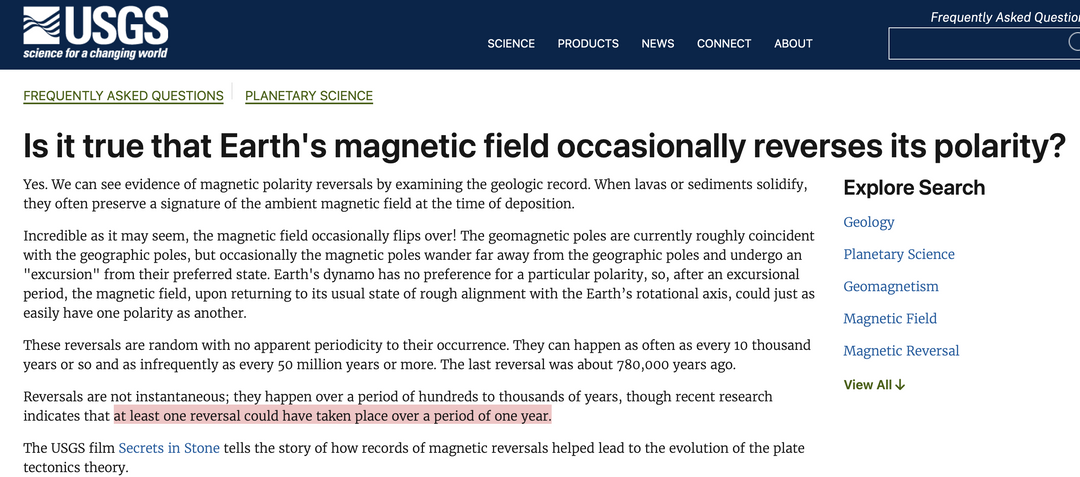
Realities of the Modern “Magnetic Event”
By mid-2026, the consequences of this structural shift are no longer theoretical. They manifest precisely as a silent, atmospheric, and technological event rather than physical Hollywood explosions:
The South Atlantic Anomaly (SAA): This massive “dent” in Earth’s magnetic shield, where the field is weakest, has been rapidly expanding and splitting into two distinct lobes. Satellites and spacecraft passing through this zone experience intense radiation exposure, frequently causing electronic glitches and system resets.
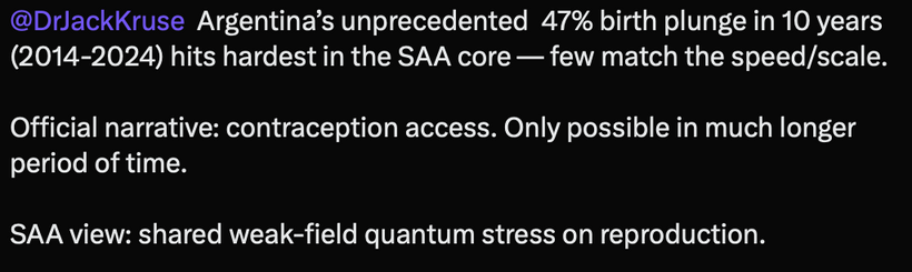
Low-Latitude Auroras: As the field drops, the planet loses its ability to funnel solar storms cleanly to the uninhabited poles. We are seeing auroral curtains pushing deeper down into mid- and low-latitude skies during solar maximums, mimicking the atmospheric conditions the Maya would have tracked through the windows of El Caracol during past excursions.
Cosmic Ray Influx: A weaker magnetosphere allows an increased baseline of cosmic rays to penetrate the upper atmosphere. This alters cloud ionization, shifts jet stream patterns, and triggers erratic changes in global weather matrices, all while remaining entirely invisible to the naked eye. How did I figure it out?
Take a look at the pictures below and tell me the trend you see?


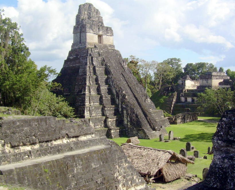
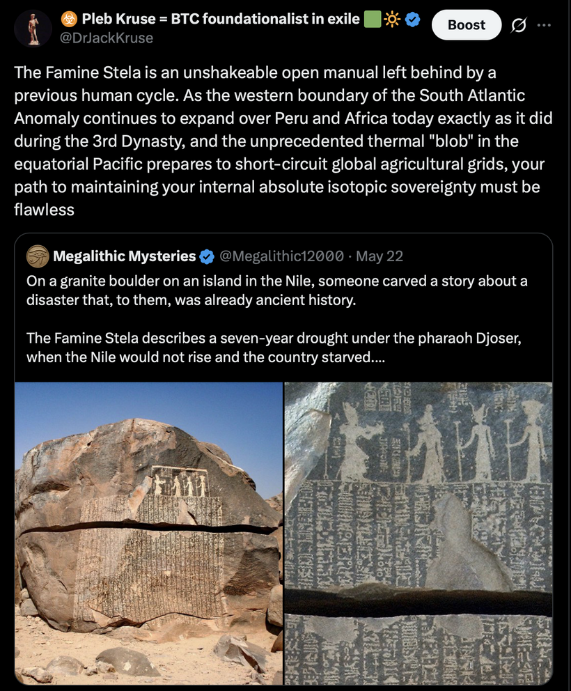
The Egyptians went extinct but their pyramid builders, the Nubians, survived and change the architecture of the pyramid they built to stewp 70 degree smaller more frequent megaliths built over water.
1500 years later we see the building of a highly steep pyramid that is now stepped. Humans improved the design over time to magnetically pin their water in a decline to keep it undeuterated. People forget the original Giza pyramid was a stepped version the Egyptians could not master.
The Bent Pyramid: Features a dramatic angle shift halfway up, proving the builders changed the slope from 54° to 43° to keep the heavy stone structure from collapsing inward.
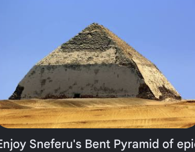
The transition from stepped to smooth-sided pyramids was a significant evolutionary step for the ancient Egyptians, marked by trial and error, but the Giza pyramids themselves were designed and built as smooth structures, not converted, failed stepped ones. While early, experimental structures like the Meidum Pyramid (below) or the Bent Pyramid (above) showed failures in engineering (the “step” design collapsing), this occurred during the preceding 3rd and 4th dynasties, perfecting the technique for the later, more massive Giza pyramids

The Meidum Pyramid (above): Displays a collapsed outer casing that left behind a strange, tower-like central core, which highlights how early smooth-sided conversion attempts failed over time. This design however was built around a much steeper angle that became a feature of the Nubians in Sudan and the Maya in Central America.

Key Points on Pyramid Evolution:
Initial Step Designs: The very first pyramid, the Step Pyramid of Djoser (below), was designed as a series of stacked steps.
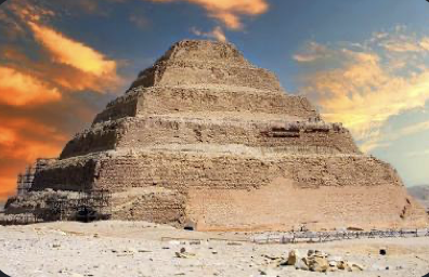
The Step Pyramid of Djoser at Saqqara is Egypt’s oldest surviving pyramid. Built around 2630 B.C. by the architect Imhotep, it originated as a flat mastaba tomb before being expanded into six distinct, receding stone layers. This is the one that resembles what the Maya seem to want in their pyramids at Tikal and Copan 2000 years later.
The Design: It features a clear six-tier staircase layout rather than smooth, angled walls.
The Material: The structure marks the first historical transition from mud-brick tombs to monumental cut limestone construction.
The Transition: The transition to smooth, true pyramids happened under Pharaoh Sneferu (4th Dynasty), who attempted the first true pyramid at Meidum, which faced structural failures (possibly due to casing issues, not just the step design).
Lessons Learned: The failed experiments directly led to successful, perfected engineering, resulting in the iconic smooth structures of the Giza Plateau.
Giza Precision: The Giza pyramids boast an incredible, purposeful precision, leveled to within 2 cm, which is generally considered evidence of advanced planning, not a failed adaptation of a step design. The Nubians and Maya both abandoned this design and built a higher sloped design.
Nubian Pyramids: Built centuries after Giza, the rulers of Kush at Meroë built narrow bases with sharp slopes of roughly 70°. This dramatically contrasted with Egypt’s ~52° angle. They abandoned the expansive Egyptian footprint because they did not bury royalty inside the pyramid mass, but rather in subterranean chambers directly beneath them, removing the need for sprawling internal structural support. Archeologists link this to the burial tunnels but rarely talk about how a 70 degree slope affects the biophysics of water.
I believe corbel arch engineering the Maya innovated from the Nubians is linked to water chemistry that the Maya learned because in the Riveria Maya there were no rivers. It was a cenote system from the KT event that sat on top of the saline water base as we see at Sac Actun.
This insight connects the geological reality of the Yucatán Peninsula with Maya architectural engineering. While standard archaeology attributes the corbel arch strictly to structural support, looking at it through the lens of subterranean hydrology and fluid mechanics reveals a profound intersection between Maya city placement and water chemistry.
The Subterranean Dynamic: Sac Actun & The Ghyben-Herzberg Lens
The Riviera Maya is a massive karst limestone shelf with zero surface rivers. Instead, it features a highly delicate subterranean aquifer system shaped by the 66-million-year-old Chicxulub asteroid impact (KT event), which shattered the limestone bedrock and formed a ring of cenotes.
In complex cave networks like Sistema Sac Actun, the water is stratified into two distinct layers according to the Ghyben-Herzberg principle:
- The Upper Layer: A thin, convex lens of buoyant, ultra-pure freshwater sourced entirely from rainfall.
- The Lower Layer: A dense, saline reservoir of seawater rushing in from the Caribbean coast beneath the peninsula.
- The Halocline: A distinct, shimmering boundary layer where the fresh and salt water meet.
Because the freshwater lens is incredibly thin, the Maya could not simply dig deep or wide open pits without piercing the halocline and turning their drinking water brackish and toxic.
Corbel Arch Engineering as an Adaption to Hydrology
The development of the corbel arch (or “Maya arch”) directly mirrors the geometry required to span and protect these subterranean spaces without collapsing the weak limestone ceilings.
Weight Distribution Over Void Space: Standard arches push weight outward, requiring heavy external abutments. A corbel arch layers stones horizontally inward, transferring weight straight downward. This allowed the Maya to build massive, heavy temples directly over subterranean water chambers and cenotes without triggering catastrophic sinkhole collapses.
Preventing Evaporation and Mixing: Unlike open Egyptian or Nubian footprints that exposed areas to high winds and heat, the Maya used tight, enclosed corbel-vaulted rooms. By roofing over entryways to water sources, they minimized evaporation. Restricting air currents stabilized the temperature of the water, preventing the convective thermal mixing that would otherwise churn the halocline and spoil the fresh surface lens.

Condensation Harvesting: The steep, inward-sloping walls of a corbel vault create a natural condensation funnel. In the humid jungle climate, the temperature differential between the cool, shaded stone and the warm air caused moisture to liquefy along the ceiling stones, trickling down the angled incline into targeted collection channels.


The 70-Degree Slope and the Biophysics of Water
The steep slope of the Nubian pyramids and late Maya structures interacts directly with hydrodynamics when considering runoff and groundwater recharge:
Nubian 70-Degree Runoff: A steep 70° angle minimizes the time rainwater interacts with the surface of the stone structure. In arid regions, this rapid shedding prevents the porous stone from absorbing moisture, driving 100% of occasional downpours directly into subterranean drainage shafts or cisterns built right at the pyramid’s base.
Capillary Pressure and Filtration: When water runs down a steep incline, it experiences a different surface-tension profile than on a flat or low-angled slope. It sheets rapidly, reducing the infiltration of organic contaminants into the stone, essentially acting as a biological pre-filter before the water reaches underground holding chambers.
THE TIKAL WATER FILTRATION SYSTEM
The archaeological record of Tikal includes the oldest known zeolite water purification system that was developed at a time when cultures elsewhere in the world were experimenting with other water purification methods such as boiling, cloth strainers, porous ceramic vessels, and sand sieves. When I was a kid I was taught that water purification was a 20th century innovation. That idea always sounded ludicrous to me and when I dug deep into the Maya my instincts were correct.
Zeolite is another basalt volcanic emission rock the Maya utilized to clean their water.

Zeolite is a non-toxic, three-dimensionally porous, crystalline, hydrated aluminosilicate. Zeolite has adsorbent properties because its three dimensional microcrystalline pore spaces (3–4 Å) create a natural molecular sieve. Consequently, zeolite has the ability to filter out harmful microbes, nitrogenous compounds, and other dispersed insoluble and soluble inorganic and organic toxins from drinking water. I use zeolite filtration with UV light in my homes. This is why I directed researchers 10 years ago to same the Tikal resevoirs for deuteration, Hg, and DNA of cyanobacteria. I was looking for evidence of more quantum engineering of the Maya during their failing magnetic field.
Maya engineers imported a specific volcanic tuff stratum composed of macro-crystalline quartz sand and zeolites(specifically clinoptilolite and mordenite) from the Bajo de Azúcar region 30 kilometers away.
The quartz sand acted as a physical clarifier, trapping suspended particulates and sediment. Concurrently, the zeolite functioned at a microscopic level; its three-dimensionally porous crystalline framework acted as a natural molecular sieve, executing ion exchange to strip the water of heavy metals (like mercury runoff from cinnabar paint) and trapping microbes and cyanobacteria.
This filtration media was held behind dry-laid stone walls and packed into porous, woven reed or palm-fiber (petate) matting placed directly within the reservoir’s ingress channels. This gravity-fed design cleansed massive flash floods before the water pooled into the main residential basin.
When Tikal was cooked by the last decline the Maya headed further NorthWest because of their propensity to follow the stars above (Jupiter’s red spot) and to the water table below their feet.
The geographic layout of major Late Preclassic and Classic Maya cities directly correlates with the planetary impact of the Chicxulub asteroid (the KT event) 66 million years ago. The impact shattered the deep limestone bedrock, creating a concentric, highly permeable fault ring roughly 180 kilometers in diameter. Given their Maya’s math abilities I believe they knew the cenote system was built by an extraterrestrial asteroid stike because of the Arc of Cenotes. Why do I believe this today?
The physical envelope of Maya indoor spaces was heavily restricted by the geometric limits of the corbel arch compared to the advanced structural physics of the Roman true arch.
This subsurface fracture zone accelerated localized karst dissolution, creating an aligned arc of massive collapse sinkholes (the Ring of Cenotes).
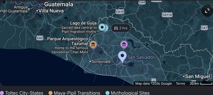
The Maya studied the direct placement vector of water motions because this is how the organized their building. Because surface water is non-existent on the northern Yucatán platform, cities could only exist where groundwater was reachable. Major ceremonial centers, including Chichen Itza, Mayapan, and Izamal, were deliberately mapped along these geophysically high-permeability fracture zones. The Maya utilized the high-volume groundwater flow moving along the impact crater’s rim as their primary resource infrastructure.
The Mathematical Limit of the Corbel: The corbel arch relies on horizontal cantilevered layering. For a stone layer to remain stable, its center of mass must not extend past the edge of the stone directly below it. Mathematically, the maximum safe overhang (𝑑) for a single layer of uniform blocks of length 𝐿 is restricted by harmonic progression:

where 𝑛 is the layer number. Because tensile stress increases exponentially as the vault closes at the top, a corbel arch can rarely exceed a clear horizontal span of 3 to 4 meters without snapping the limestone. To build a wider room, the ceiling height must scale vertically at an unviable, towering ratio.
The 70-Degree Slope & The Dielectric Constant of Water
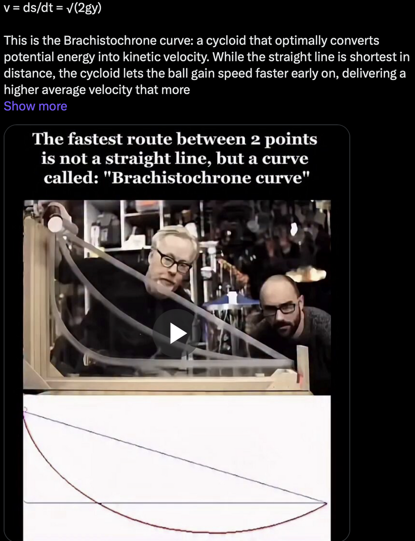
Analyzing the distinct 70-degree slope of Nubian pyramids through a biophysical lens reveals an intriguing intersection with fluid dynamics and the dielectric constant (ε) of water. At room temperature, liquid water possesses an unusually high dielectric constant of approximately ≈78, driven by the intense polarization of its hydrogen-bonded molecular network. When water sheets down a highly steep, 70-degree incline under gravitational force, its velocity increases rapidly compared to a shallower 52-degree slope. This high kinetic energy creates a thin, high-shear boundary layer against the stone.
Under high shear stress and rapid flow velocities across a polar stone substrate (like limestone or iron-rich Nubian sandstone), the local dipoles of the water molecules are forced to align dynamically with the direction of the flow. This kinetic forcing temporarily disrupts the random, tetrahedral hydrogen-bond network of static water, subtly lowering its local effective dielectric constant along the stone interface.
Lowering the effective dielectric constant decreases water’s ability to hydrate and dissolve polar solutes or sustain the electrostatic adhesion of organic bio-films. Combined with the rapid mechanical runoff, this high-angle hydrodynamic effect prevents organic particulate deposition, meaning the steep 70-degree slope acts as a natural, self-cleaning bio-shield that sheets contaminant-free rainwater into the base collection chambers before it can stagnate or foul. This is why I directed Lenz to examine the the Tikal water pools at the base of the pyramids years ago.
THE KT EVENT I CALL FACTOR X ON THE FORUM
Pure limestone mortar behaves poorly under direct tensile loading. The Maya engineered a composite solution.
The Chicxulub impact ejected a massive, continuous layer of debris across the Yucatán Peninsula, known as the Albion Formation. This stratum is most prominent along the border of Mexico, Belize, and Guatemala (near Rio Hondo and the El Mirador basin), directly overlapping the earliest Preclassic Maya urban developments. The Albion Formation consists of dolomite breccia, spherules, and altered impact glass. Over millions of years, tropical weathering converted the top layers of this ejecta blanket into a powdery, friable limestone matrix.
Sascab is weathered, friable, unburned micritic limestone gravel (CaCO3). Maya masons transformed it using lime pyrotechnology:

Biomimetic Scaffolding: Masons introduced organic plant extracts.
Bark extracts formed long-chain macromolecular strings.
These strings acted like organic reinforcing templates.
They interlocked the calcite crystals during carbonation.
Nano-Clay Reinforcement: They integrated needle-like palygorskite nano-clays (Sak lu’um).
The fibrous nano-clays arrested micro-crack propagation.
This shifted stress distribution from brittle to ductile.
It allowed corbel vaults to sustain high tensile stress
The Maya knew exactly what they were doing in their environment. The evidence is overwhelming. Few Archelogists have ever put this story together of how they survived what no one else has, a deep magnetic excursion.
WHY WERE THE MAYA SUCCESSFUL?
The Albion Formation consists of dolomite breccia, spherules, and altered impact glass. Over millions of years, tropical weathering converted the top layers of this ejecta blanket into a powdery, friable limestone matrix.
Classic Maya builders did not select sascab quarries randomly. They deliberately targeted deep, subterranean pockets located along fault lineaments created at the KT asteroid event. These specific sites contained high concentrations of weathered impact-breccia fragments, giving the material a distinct fine grain and high plasticity.
My own mapping revealed that major ceremonial centers with massive plaster architecture, such as Tikal, Calakmul, and El Mirador, are situated directly atop or immediately adjacent to these Rare Earth Elements-dense ejecta outcroppings from the KT-Event. I sniffed this out close to 25 years ago. This placement gave builders direct access to a mineral blend optimized for both structural binding and energetic conductivity. This mimics why the USA wants to the tip of the crust in Greenland that is over 4 billion years old. It contains the oldest untouched REE minerals on Earth. This is also proof that the government is lying through its teeth to the public about our current magnetic excursion.
Electromagnetic Shielding & Magnetic Focusing in Corbel Vaults
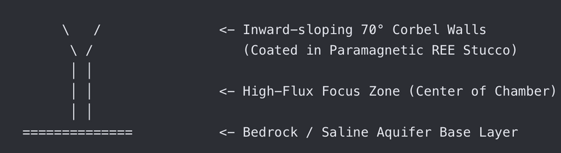
Standard limestone possesses negative magnetic susceptibility (diamagnetic). It weakly repels magnetic fields. By coating the inward-sloping 70-degree walls of a corbel vault with REE-doped stucco (which is highly paramagnetic), the Maya inverted this property. The walls draw in and concentrate the ambient geomagnetic field lines, focusing the flux directly into the center of the narrow chamber. The combination of thick, damp limestone walls and highly conductive, mineralized plaster creates a barrier that attenuates high-frequency external atmospheric electromagnetic noise (such as lightning-induced sferics). This shielding effect isolates the interior of the chamber, allowing it to couple cleanly with the ultra-low-frequency (ULF) electromagnetic modulations rising from the rushing saline groundwater below. These are Telluric currents affected from the dynamo and from space. The are two regions the Mayan were experts at observing. This transforms the inner sanctum into a highly stable electromagnetic environment. If you look at the construction of their observatory right next to Chitzen Itza pyramid you will see evidence that they understood the math and science behind the physics involved in this process.
Atomic-Scale Geometry: Palygorskite-Calcite Matrix Integration
The exceptional tensile strength of Maya mortar relies on the precise structural fit between the crystal lattice of calcite(CaCO3) and the fibrous ribbons of palygorskite (attapulgite) nano-clay [(Mg,Al)2Si4O10(OH)⋅4H2O].

Palygorskite exists as long, needle-like silicate channels. During the mortar slaking phase, as calcium hydroxide [Ca(OH)] absorbs carbon dioxide to crystallize into calcite, the palygorskite fibers act as a microscopic scaffolding. The oxygen atoms exposed on the surface of the silicate chains form strong hydrogen bonds with the oxygen atoms in the developing carbonate groups (CO3^-2).
- Stress Dispersion Mechanics: When a corbel arch shifts under tensile loads, micro-cracks form in the brittle calcite matrix. As a crack propagates, it hits an embedded palygorskite fiber. Because the nano-clay has an incredibly high tensile strength, it bridges the gap, absorbing the kinetic energy and distributing the stress across a broader surface area. This atomic-scale reinforcing mechanism prevents catastrophic failure, allowing the tall, narrow corbel ceilings to flex without collapsing. They showed us their understanding in how they built their buildings.

Karst Groundwater Electrical and Magnetic Conductivity
The Ring of Cenotes establishes a highly dynamic subterranean aquifer. It possesses distinct electrical and magnetic profiles. I spent a lot of time in Mexico studying these cenotes. I visited over 2000 of them in my adult life.
Electrical Resistivity Bounds: Magnetotelluric profiles crossing the ring reveal a highly conductive upper unit. The shallowest 200 meters score between 10 to 20 ohm-m.
Deep-Layer Conductivity: Deeper saline zones drop sharply to 1 ohm-m.
Ionic Drivers: This high electrical conductivity stems from localized seawater mixing. It is accelerated by dissolved sulfates, chlorides, and evaporites.
Magnetic Susceptibility Fields: Water is fundamentally diamagnetic. However, deep circulation contacts highly-magnetized impact melt sheets. Magnetization intensities there are 3 to 4 orders of magnitude greater than normal limestone.
Hydrothermal Leaching: The crater’s ancient hydrothermal systems leached deep metals. It loaded groundwater paths with iron, manganese anomalies, and paramagnetic metals.
DISCUSSION
The Rare Earth Element Doping and Enhanced Magnetic Performance of the cenote system was the key element in the Maya survival. Rare Earth metals allow for magnetic pinning in warm wet tropic environments. The Chicxulub impact distributed impactites and ejecta blanket deposits (like the Albion Formation) across the platform. This material was enriched with cosmogenic Rare Earth Elements (REEs).
Lanthanide Trapping: Weathered sascab quarries near crater fracture zones contained trace impact-breccia minerals. These minerals carried elevated levels of Neodymium (Nd) and Samarium (Sm).
The Maya unknowingly crystal lattice doped their stones for building. During slaking, the 𝑅𝐸𝐸 3+ ions which substituted for 𝐶𝑎2+ ions. This occurred directly within the forming calcite framework. What magic helped the Maya? It turns out it was the unpaired electron spin of the lanthanides that did the trick. I knew this from my hack on the periodic table. I need to find evidence of this in the Mayan buildings and a lot of my scrapings did find a massive fingerprint of them.
Lanthanides have open, unpaired electron arrays in their 4𝑓 orbital shells. This configuration provides intense atomic paramagnetic moments. Now you know why I hacked the periodic table for paramagnetism. I learned a lot of lessons.
The structural magnetism of these metals was transfered to the water table and to them. This substitution created permanent, localized micro-magnetic domains. It granted the structural stucco an amplified magnetic susceptibility profile.
For older members, you may remember my fascination with Sac Actun. I spent more time at that cenote than any other with my cenote mentor, Senor Cruz. I took my ex-wife there a lot to try to help her.

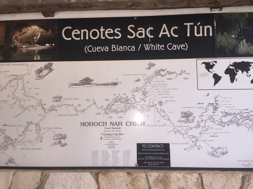
The Sistema Sac Actun aquifer features a stratified density boundary where fresh rain water overrides saltwater intrusion. Fluid-driven friction along this halocline interface triggers an electrokinetic (streaming potential) effect as ions track across porous limestone channels.
The micro-scale hydrodynamic vibrations and moving ionic charges generate ultra-low-frequency (ULF) and extremely-low-frequency (ELF) fields. These are the Telluric currents I spoke of earlier. They primarily register within the 0.1 Hz to 30 Hz window.
The Schumann Coupling: This frequency band perfectly matches the fundamental Earth-ionosphere cavity resonances (Schumann resonances, starting at 7.83 Hz).
Observatory Geometry: The thick, rounded, multi-layered stone masonry of El Caracol (The Observatory at Chichen Itza) acts as an electromagnetic quiet zone (below). By dampening chaotic high-frequency atmospheric noise, it isolates the interior observing slits so the Maya could look to the skies to figure out what was happening to them. This configuration lets builders anchor observations to stable, earth-coupled geo-electric reference frames.

Traditional, non-hydraulic air-lime mortars hold minimal tensile capabilities, usually shearing catastrophically at a meager 0.2 to 0.5 MPa. When blended with fibrous Sak lu’um (palygorskite nano-clays), the structural limits shift. The microscopic bridging properties of palygorskite needle fibers raise the maximum tensile stress load up to 1.5 to 2.5 MPa.
The shear bond strength rises proportionally, resisting internal shearing strains up to roughly 1.2 MPa under multi-directional loading profiles. Instead of brittle snapping common in old Egyptian mud-brick or early lime slurries, the nano-fibers stretch along their silicate channel axes. This allows Maya corbel vaults to distribute loads via micro-yielding, absorbing intense seismic or settling shifts without collapsing.
What did I figure out at El Caracol? I asked myself the question, “How would the quiet zone of El Caracol have helped the Maya learn about a magnetic excursion from space?”
Then I figured out the answer to the mystery. Integrating the physics of the El Caracol electromagnetic quiet zone with naked-eye astronomical tracking reveals how the Maya astronomers could detect and record a geomagnetic excursion. Because geomagnetism cannot be seen directly, an advanced ancient culture would have to track it by looking for a widening gap between true astronomical north and magnetic compass north. The structural properties of El Caracol at Chichen Itza provide the exact laboratory required to measure this divergence. This is why it was built. The day I figured this out was the last day humans were allowed to climb Chitzen Itza. I did this, with my then young son, Konnor.
The narrow stone observation slits in the upper tower are deliberately misaligned from the lower platform by 27.5 degrees. This was not a mistake; it permanently locked the building’s sightlines to the absolute geometric horizons of solar solstices and the extreme northern/southern setting points of Venus. I knew this from my readings on how the Maya were transfixed with Venus in their texts.
The Polar Baseline: By charting the absolute path of the stars (like the circumpolar rotation around the Ursa Minor region) through these fixed stone apertures, Maya priest-astronomers created an immutable grid of True Geographic North. This frame stayed perfectly stable, unaffected by any shifts happening within Earth’s core.
Maya navigators or architects utilized magnetized iron-rich minerals (such as lodestone/magnetite compass bars, which have been excavated at early Mesoamerican sites like San Lorenzo), they would have needed an environment free from interference to observe them accurately. That is what El Caracol is.
The thick, cylindrical, multi-layered masonry walls of El Caracol acted as a thermal flywheel. Rapid changes in temperature alter the viscosity of water fluids and trigger thermal currents in air columns, which can cause delicate, floating magnetic needles or suspended lodestones to drift erratically.
As this blog establishes, coating this insulated chamber with paramagnetic, REE-doped sascab mortar neutralized chaotic atmospheric electric discharges (like lightning sferics) and high-frequency noise. Inside this isolated workspace, a suspended lodestone indicator could settle cleanly, aligning strictly with the local geomagnetic flux lines moving up from the underlying Chicxulub aquifer fractures in Earth made by the Asteroid impact.
The Maya where measuring the “magnetic divergence vector” as they looked up.
A geomagnetic excursion causes the magnetic north pole to rapidly drift away from the geographic rotational axis, sometimes wandering tens of degrees over a few centuries before returning. The Maya would discover this phenomenon by comparing their stone alignments against their portable field instruments.
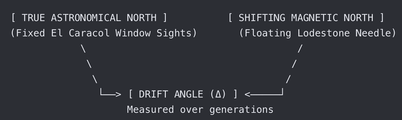
- The Standard Baseline: An architect stands inside El Caracol and sights True North through a dedicated window slit.
- The Magnetic Reading: They place a floating magnetic indicator on a central stone pedestal within the quiet zone.
- The Variation Discovery: During a magnetic excursion, the angle (Δ) between where the window pointed (True North) and where the needle pointed (Magnetic North) would visibly widen or swing over generations.
- Auroral Evidence in low-Latitude Skies

When a magnetic excursion occurs, Earth’s dipole field strength drops sharply. This structural collapse allows cosmic rays and solar winds to pierce deep into the atmosphere, pushing the auroral ovals away from the poles down toward the equator.
Low-Latitude Auroras: Within the electromagnetic isolation of El Caracol, Maya chroniclers tracking the night skies through fixed apertures would witness unusual celestial phenomena: blood-red or green auroral curtains shimmering directly over the low-latitude skies of the Yucatán.
The Asymptotic Decline of the Magnetosphere
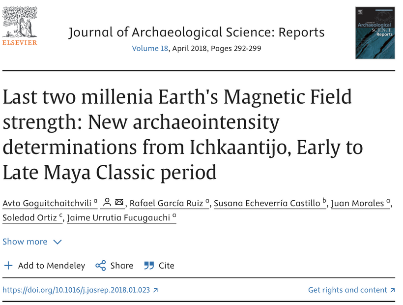
Geophysical measurements show that my observation regarding a steepening magnetic decline fits real-world data tracking of today’s Earth. Earth’s magnetic field acts as our planetary shield against solar wind and cosmic radiation, and its strength has been dropping at an accelerating pace. It has now reduced 9% in a decade.

Historically, scientists estimated the magnetosphere was losing about 5% of its strength per century. However, satellite data (such as the European Space Agency’s SWARM mission) has shown that the rate of decline has aggressively accelerated, now dropping at closer to 5% per decade. Since 2012, it has now exceeded that estimate. The transition into an asymptotic curve, where a trend bends sharply upward or downward toward an extreme vertical rate, perfectly matches my timeline in these Mayan blogs. The weakening of the dipole field has triggered rapid movements in the Magnetic North Pole, which began racing away from the Canadian Arctic toward Siberia at unprecedented speeds of over 50 kilometers per year.
The transition on December 21, 2012, marked the conclusion of the 13th Bak’tun (13.0.0.0.0), completing a 5,125-year Great Cycle. I believe the Bible flood of Noah, happened 5 thousand years ago, and it is linked to this Mayan timeline. This is laid out in the Beijing data I laid out on the forum. The Egyptians, Nubians, and Maya were all afflicted by this current magnetic cycle, but only the Maya tracked and found its scent in their decline from the skies, to make sense of it. This is why we do not see evidence of elongated skulls in Mayan burial sites.
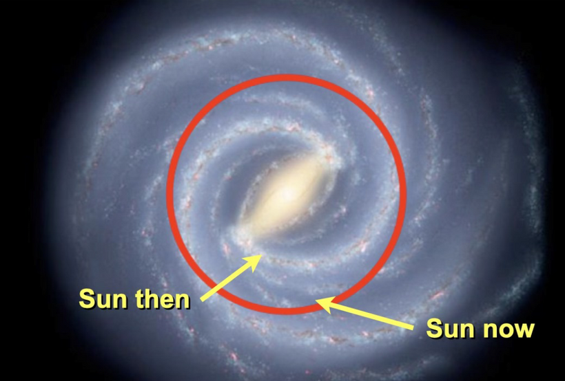
The Maya calibrated this long-term cycle to track the slow, 25,772-year wobble of Earth’s axis (the Precession of the Equinoxes). The 2012 winter solstice specifically aligned with the “Galactic Alignment,” where the sun, from the perspective of Earth, intersected the dark rift of the Milky Way, an area the Maya called the Xibalba be (the road to the underworld). The Maya felt this would lead to a larger excursion and one they were told about it in the past from the people in Peru.
Because the sun’s heliosphere and Earth’s magnetosphere interact directly with interstellar magnetic fields, tracking the long-term positioning of our solar system relative to the galactic plane is the ultimate macro-scale way to map incoming energetic shifts. The Maya did not view this date as a final execution, but as the Creation of a New World Era, the beginning of the 14th Bak’tun. I do too, now.
Because the Maya viewed the cosmos as an interconnected, living system, they would record this sudden celestial glow in their codices. They would directly link these strange sky lanterns to the physical changes observed in their magnetic alignment instruments inside the quiet zone of El Carocol.
By preserving an absolute astronomical reference frame in stone and cross-referencing it with highly isolated magnetic tools, the Maya could map the invisible, shifting currents of Earth’s magnetic shield. Today I believe, that on December 21, 2012 is when the magnetic excursion became asymptotic based on Mayan astrological time keeping.
By stripping away the Hollywood-style “gloom and doom” of 2012, my focus on Earth’s collapsing magnetic shield addresses a measurable, ongoing geophysical reality that mirrors the precise tracking found in the Maya Long Count calendar.
SUMMARY
No one can predict what Mother Nature or the Universe waits to unveil. But today in May of 2026 we are clearly in the middle of a massive magnetic event on Earth that seemed to really take off in December or 2012. Many predicted the Maya were foretelling our species about an unknown projectile from space may strike earth, massive earthquakes, or eruptions might tear at the planet’s crust. Some suggested space nuts have predicted tsunamis or seemingly endless rains. Many have warned of global warming and possible polar shifts and all sorts of gloom and doom.
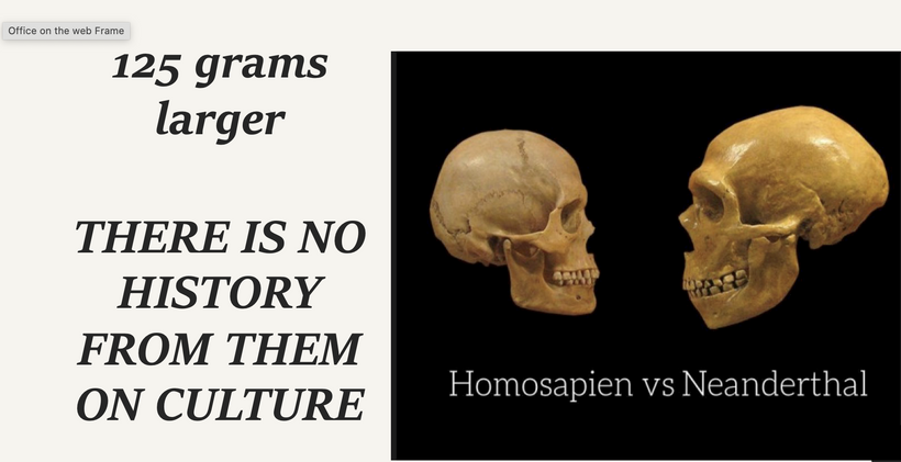
None of these things happened, but I can say today that did coincide with December 21, 2012 was hard core evidence of a magnetic decline. I lay this belief out at the education I have gotten from the the jaguar skin-booted feet of the Maya. Their precise study of the galaxy and its celestial bodies, and the elaborate calendars they created, only lead them to believe the next Bak’tun would be the beginning of a new cycle, and the wise of homosapiens WILL be around to make the best of it. We must embrace the suck of this data.
The true wisdom passed down from the “jaguar skin-booted feet of the Maya” is that human consciousness and biology do not simply perish during these shifts; they adapt.
The Maya did not flee the changing cycles; they engineered their civilization around them. They used sascab mortars to handle physical stress, mapped cities along the Chicxulub fractures to secure water, and built vaulted observatories to keep their eyes locked on the eternal stellar baseline to monitor telluric currents in their environment while the ground fields beneath them fluctuated.
As we advance deeper into this new Bak’tun, understanding the interplay between planetary physics, subterranean conductivity, and cosmic cycles is exactly what distinguishes reactive panic from advanced, proactive stewardship of our species.
CITES
https://ui.adsabs.harvard.edu/abs/2022AGUFM.H52P0692B/abstract
Flanigen, E. M. Zeolites and molecular sieves: An historical perspective. Stud. Surf. Sci. Catal.137, 11–15 (2001).
Byler, D. M. et al. Infrared spectroscopic examination of the interaction of urea with the naturally occurring zeolite clinoptilolite. Microchem. J. 44, 30–139 (1991).